M53. The Mid-Wirral Motorway

In the 1960's, Vauxhall Motors decided to build a car factory at Hooton, Ellesmere Port, on the site of a disused airfield. However, the existing road access was totally inadequate.

A new road network was required within the immediate area, to serve the development. Not only was it essential for the supply of raw materials, and as a reasonable means of access for employees, but it was required also for the delivery of finished vehicles to markets in all parts of the country and abroad.

The site was close to Ellesmere Port itself, at the western end of the Manchester Ship Canal, and near to the Docks at Birkenhead and Liverpool.

In particular, access was needed to the A41, the major road between Chester and Birkenhead.

In view of the employment which the factory would bring to the area, the Cheshire County Council was keen to assist in the development. Following negotiations with the Company it was agreed that a new dual two-lane carriageway road would be constructed from a junction with the A41 at Hooton, and a junction with the A5032 immediately north of Ellesmere Port, both of which would be grade separated. The latter would link directly into the site of the new factory and its cost would be met by the Company.

Both the factory and the 2½ mile long road, known initially as the 'Hooton Industrial Road', were built concurrently by the same Contractor.

Although primarily serving the needs of the factory when completed in 1968, it soon became apparent that there was an expanding need for even better facilities. It was decided, therefore, to extend the road southwards, through Ellesmere Port for a further 2½ miles, as far as the A5117 and to provide grade separated junctions. On completion of this section, in the summer of 1975, and upgrading to a dual two-lane carriageway standard, the whole length was designated as the M531, the first 'county motorway' in Cheshire.

Meanwhile, in 1965, G Maunsell and Partners, the firm of Consulting Engineers, was appointed by the Ministry of Transport to carry out a location study for a new route serving the Wirral Peninsula generally. It was to commence from the southern end of the second Mersey Tunnel (Wallasey-Liverpool), at Bidston, and terminate in the Hooton-Sutton area.

Parliamentary Powers for the construction of the second Mersey Tunnel had been granted in 1964 and work on a pilot tunnel had commenced early in 1966. In their Report submitted in the August of that year, the Consultants recommended that the new route should be a dual three-lane motorway from the new Tunnel approach road in Wallasey to connect with the 'Hooton Industrial Road', which was then under construction.

It was further recommended that, in due course, the route should be extended further southwards across the A5117 to a connection with the A41 near Backford.

The proposed road was then designated the M53 and, in 1967, the firm was appointed to undertake the detailed design of that part of the route north of Hooton.

Following a Public Inquiry, a Contract for its construction was awarded, and this included provision for a future interchange at Hooton to accommodate the recommended extension.

The works commenced in July 1969 and included the construction of four interchanges at Moreton, Woodchurch, Clatterbrige and Hooton, along its 9 mile length.

The site investigations along the route had shown predominantly Glacial Boulder Clay overlying Pebble Beds and Bunter Sandstone with some Keuper Marl at the northern end. Low-lying ground in the Fender Valley has deposits of soft peaty clay and silt up to 25 feet thick.

It was recognised at the design stage that, for a length of one mile between Upton Road and Woodchurch, the soil was low-quality alluvium of considerable depth and that special requirements should be specified. These included pre-drainage, the restriction of heavy plant, dry-weather operations only, and the use of selected materials. All material, whether in cuttings or under future embankments was removed for 2 feet 6 inches below formation level and replaced with rock layers.

In the areas of severed land inside the loops of the Moreton Spur connecting roads, the Contractor excavated borrow pits which were reinstated with unsuitable material.

Rock blasting was forbidden in the area adjacent to Clatterbridge Hospital but it was found to be possible to excavate the rock by 'ripping'.

At Moreton a spur road designed and constructed to motorway standard provided the link to serve the Upton/Moreton area. The layout divided the heavy commuter traffic from that using the motorway, by means of exceptionally long slip road connections with relatively easy curves. This was possible because of the low agricultural value of the low-lying area of the Fender River valley.

The design of the Woodchurch Interchange was unusual and, at that time, the only one of its type in the country. It is, in effect, a three-level interchange fitted into a two-level site, by having an elongated roundabout with rising gradients. Features controlling the design were the limited headroom under, and in close proximity to, a railway; the Fender River flood water levels; a nearby block of flats; and the limited availability of land due to new development.

Compared with a compact three-level interchange, the adopted design saved about 800,000 cubic yards of imported filling and 500 feet length of viaduct.

A total of 41 bridges was required and, with the exception of two post-tensioned segmented spine bridges, they all comprised precast pretensioned concrete beams. There are two viaducts of eight and ten simply supported spans.

A piled raft formed the base construction of over a mile of carriageway with a total area of 42,000 square yards in the Fender Valley, where peat and silty alluvial sands reached depths of up to 20 feet. The 13 inch thick reinforced concrete slab was supported on driven cast in-situ piles varying in length from 35 to 50 feet at 14 to 16 feet centres. It was necessary to form a shallow embankment as an essential prerequisite to the piling in order to provide access over the bad ground for plant and materials.

Although the cost was high, it showed a considerable saving compared with the alternative of peat excavation and replacement with imported filling.

The Contract was completed in February 1972, following the opening to traffic of the first 'bore' of the second Mersey Tunnel, in June 1971.

The Consultants had recommended that the extension through to Backford, which would provide a by-pass of the A41 and give traffic relief for Sutton, should continue as part of a phased programme of construction. Clearly, however, the upgrading of the route through Ellesmere Port, as the M531, made the prospect of this being achieved in the foreseeable future, very unlikely.

In March 1981, the M531 was further extended by a County Council Contract for the construction of a seven span viaduct over the A5117 roundabout and a one mile length of dual two-lane carriageway motorway to link in to the interchange with the M56 at Stoak. This scheme was completed as M53, and the remainder of M531 renumbered at this stage.

Work on the construction of the final section of the Mid-Wirral Motorway began in June 1980. From Stoak Interchange, it extended over a length of almost 3 miles to connect with the A56 at Hoole Village, on the outskirts of Chester.

It required the construction of four underbridges and two overbridges, the most significant being a four span crossing at the Shropshire Union Canal.

Alternative tenders had been invited by Cheshire County Council for flexible and rigid construction, for the dual two-lane carriageways. In the event, the lower of the tenders, involving concrete construction, was accepted. The Contractor elected to lay the 11 inch thick reinforced slabs for each carriageway, with its adjacent hard shoulder and central reserve edge strip in a single 38 foot width, between fixed forms.

For most of its length the motorway was to be on shallow embankment less than 6 feet in height, the main exception being at the southern end where it reached 25 feet.

In order to ensure the uninterrupted progress of the SGME concreting train, it was necessary to complete all the structures and side road diversions in the first 12 months of the Contract. Sections of flexible construction were to be provided at the underbridges.

The concreting train was required to lay the slabs in two layers, with the upper 3 inch thickness in air-entrained concrete. Using limestone aggregate, construction joints were to be spaced at 20 feet intervals.

The laying of the concrete slabs for the two carriageways was carried out in 12 and 9 working days respectively. The maximum length laid in a single day was nearly 1800 feet.

The section of motorway was opened to traffic in July 1982.


A55 Extension to the Welsh Border

A55. Connections to the North Wales Coast Road.

As long ago as 1924, there were proposals for a 'ring road' around Chester and by the 1930's the north eastern section had been completed. Although some progress was made in furthering the scheme during the 1940's, it was not until 1961 before an Order was made relating to a route for a southern section of the 'ring road', as a diversion of part of the A55 and later to be known as 'Chester Southerly By-pass'.

It was envisaged that the By-pass would extend from the A41 Whitchurch Road, east of Chester, through to Broughton in North Wales. Based on predicted traffic flows it was considered that the section between A41 and A483, Wrexham Road, should be designed to motorway standards to form an ultimate link into the national motorway system via the proposed M53 and M56 routes.

Following extensive Public Consultation, and negotiations between the Department of Transport and the Welsh Office, the statutory procedures were completed in September 1972, following an earlier Public Inquiry. The Orders were, however, only in respect of an 'all-purpose road' and not a 'motorway', although it was the publicised intention to apply a Special Road Order, on opening, in order to restrict its use.

The most significant features in the design and construction of the 6½ mile long dual two-lane carriageway By-pass were the River Dee Crossing and the problems associated with alluvial deposits to the west of the River, and across the Balderton Marsh area.

The By-pass was completed and opened to traffic in December 1976, when the Secretary of State for Wales announced the timetable for the completion of the dualling of the whole of the A55 from Chester to Holyhead. This represented a major investment in North Wales and a commitment to provide an improved link to the port of Holyhead, serving Ireland.

There was, however, the 'Missing Link'. For many years there had been serious problems of traffic congestion on that section of the A41 between the eastern end of the By-pass and the A56, north of Chester.

Although the road has dual carriageways, it has many junctions and sub-standard visibility where it crosses railways and a canal. Carrying a large volume of industrial and tourist traffic to both Chester and North Wales, the situation was exacerbated by the completion of the M53 in 1982.

Work on the construction of the 3 mile dual two-lane carriageway all-purpose 'Missing Link', under a Cheshire County Council contract, began in October 1989. With grade separated interchanges at M53/A56, and A51 at Vicars Cross, and at the connection with the Southerly By-pass, a total of 14 bridges was required.

Its completion in June 1991 achieved the objective of providing a continuous high standard route into North Wales. It is regrettable however, that at a comparatively minor increase in cost, it was not designed and constructed as a 'motorway'.

The Cheshire sections of A55 are also included in the full description of the A55 between Chester and Holyhead, which is included in the North Wales pages.


Archive information

 Vol. 4 M53/A55 Wallasey Tunnel

to A5104/A55 Junction at Broughton North Wales.


 The full archive information for this scheme is stored at the Cheshire CC Record Office.  Click to see details of this record office, then delete the popup page to return. 

Its Accession Number is 06115, ands its Class Reference is D6115.


1

Wallasey Tunnel to Junction 5 A41


1.1

Design


1.1.1

Letter to the Minister of Transport dated Aug. 1966 from Consulting Engineers G Maunsell and Partners enclosing their report on the feasibility of a "Mid-Wirral Road"


1.1.2

Article in the Surveyor Magazine of the 14/111972 the "Unusual Interchange designs are M53 feature"


1.1.3

Letter from Neil Collie to Eddie Naylor dated 14th Nov 1997


1.1.4

Letter from Peter F Johnson of G Maunsell and Partners to Eddie Naylor ( Retired Greater Manchester County Engineer) dated 27th Jan 1998.


1.1.5

Letter from Neil Collie to Harry Yeadon 23 Sept 1999


1.1.6

Letter from H.L.Yeadon to M.J.Lloyd re M53 dated 12 Nov 1999


1.2

Construction


1.2.1

Letter from Andrew Whitworth Resident Engineer to H.L.Yeadon 10 November 1999


1.2.2

Plan of the M53 Mid- Wirral Motorway showing the Contractors access points


1.2.3

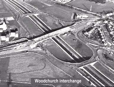
5 No Black and White Aerial Photographs of the Interchanges under construction


1.2.4

5 No Black and White Photographs of McAlpine staff witnessing trials of a concrete extruded edge detail machine


1.2.5

10 No Black and White Photographs of construction. One photograph dated Oct 1970.


1.2.6

19 No Black and White Photographs of construction


1.2.7

24 No Black and White Photographs taken in Jan 21 1972. Prior to the Opening


1.2.8

Brochure for-the Opening of the Motorway on 1st Jan 1972


1.2.9

3 No Black arid White photographs of the opening by Lord Levenhulme


1.2.10

News Release of the Opening


1.2.11

Liverpool Daily Post M53 Mid-Wirral Motorway Supplement 1st Feb 1972

2

Junction 5 A41 to Junction 8 North Road Ellesmere Port


2.1

Map of Motorway


2.2

Summary of Ellesmere Port Motorway Contracts


2.3

History of the Motorway


2.4

Background and Design and Construction Aspects by H.E.Mansley


2.5

Notes Prepared for a visit of members of Cheshire County Surveyors Society


2.6

10 No Black and White Aerial Photographs and 2 No Coloured Aerial Negatives

3

Junction 8 North Road to Junction 10 A5117


3.1

Cheshire County Council Press Release dated 6 June 1972


3.2

Construction Commentary


3.3

8 No Black and White Aerial Photographs prior to opening


3.4

Commentary by H.Genders on Labour Disputes. Not included in this volume. See H.J Stevens for details

4

Junction 10 A5117 to Junction 11 M56


4.1

Ministry of Transport Press Release dated 28th October 1977


4.2

Executive Summary


4.3

Notes on Design of-the Viaduct over the A 5117 by E.A.Bell 13 June1979


4.4

Notes on Design


4.5

Further design details by M O'Donnell March 1981

5

Junction 11 A5117 to Junction 12 A56


5.1

Press Release 21st April1980


5.2

Executive Summary


5.3

Agenda for preletting meeting 21st April 1950


5.4

Method Statement of the Plant, Materials and Operation for the laying of the concrete pavement


5.5

Construction Report by M:O'Donnell


5.6

Contract Details


5.7

Notes on a slide presentation of the Rigid Form Paver


5.8

Priced Summary of the Bridgeworks


5.9

Contractors Programme


5.10

Plan showing the ownership of the land


5.11

Minutes of Progress Meetings Nos 1,3,11 and 17. Also minutes of meeting about the opening


5.12

24 Coloured Aerial Photographs during construction


5.13

41 Coloured Photographs of concrete carriageway under construction


5.14

26 Coloured Photographs after opening

6

Junction 12 A56 to Link to A55 Chester Southerly


6.1

Map of Motorway Network around Chester and Alternative routes


6.2

A41 Improvement Technical Report Volumes 1-4


6.3

A41 Improvement Guilden Sutton Parish Council Proposal


6.4

A41 Improvement Firm Programme Report (Draft) March 1982


6.5

A41 Improvement Pre Public Inquiry Statement


6.6

A41 Improvement. Noise Report


6.7

A41 Improvement Public Inquiry. Proof of Evidence. J.A.Foskett


6.8

Local Inquiries. Inspector A Welsby


6.9

Executive Summary


6.10

Design Details


6.11

Construction by B.V.Tinsley


6.12

Four sets of Photographs taken before and during construction


6.13

Opening-Brochure 27th June 1991


6.14

13 No Coloured Aerial Photographs during construction


6.15

12 No Coloured Photographs during construction

7

A55 Chester Southerly By- Pass


7.1

Design by N D Smith


7.2

Construction by M J Lloyd, Resident Engineer


7.3

Construction by J.G.Jeliicoe, Contractors Agent


7.4

Brochure produced during construction


7.5

Opening Brochure 22nd Dec 1976


7.6

Black and White Photograph of cutting the tape at the opening


7.7

Journal of the Chester Archaeological Society Vol 59 1976


7.8

Newspaper Cutting, Chester Chronicle Dec 6th 1974


7.9

Newspaper Cutting, February 21 1975


7.10

Newspaper Cutting, December 1975


7.11

Newspaper Cutting, December 1976


7.12

Newspaper Cutting, The Chronicle December 10 1976


7.13

Newspaper Cutting, The Liverpool Echo Jan4th 1978


7.14

Newspaper Cutting, The Chronicle July 15th 1971. Interview with M.Callery Deputy County Surveyor


7.15

Photograph Dee Bridge


7.16

General Arrangement Drawings


7.17

Previous By-Pass Routes 1924,1941,1945,1961


7.18

Proof of Evidence to the Public Inquiry by B.Raistrick


7.19

English Side Roads -Order, 18th -Sept 1972


7.20

English Side Roads Order, Plans, 13th September 1972


7.21

English Main Line; Slip Road; River Dee Crossing. Statutory Instrument 1972 No 1396


7.22

English Compulsory Purchase Order Notice making 1974


7.23

Welsh Compulsory Purchase Order Notice making 1975


7.24

Half Plate photographic negatives:


12 No General Arrangements plans 1/2500

3 Key Plan and Cross-Sections

3 No Wrexham Road & Boughton Interchange plans 1 /2500


7.25

Newspaper cutting re Chester Southerly Pre-construction exhibition. Autumn 1974. 1 Page


Key Dates

The Mid-Wirral Motorway M53 and A55 Extension to the Welsh Border
Statistics and options 

Section Construction started Opened to traffic
Mersey tunnel to Hooton (J1 to J5) July 1969 February 1972
(M531) Hooton to Ellesmere Port (J5 to J8) designated as motorway N/A October 1974
(M531) Ellesmere Port to A5117 (J8 to J10) ?
A5117 to M56 (J10 to J11) ? March 1981
Stoak to Chester (J11 to J12) June 1980 July 1982
A55 Improvement at Chester October 1989 June 1991
A55 Chester Southerly By-pass ? December 1976


Note: County Motorway M531 became part of Trunk Motorway M53 in March 1981

Share
Bookmark